Observing the Earth from above profoundly transforms our perception. Landscapes lose their usual reference points and reveal unexpected forms. Lines become fluid, textures organize themselves, and colors simplify. As a result, nature takes on the appearance of an abstract composition, between science and art.
Article and photographs by Damien Lafon.
Why landscapes become abstract when seen from above
From the ground, our vision remains limited by human perspective. However, as soon as we gain altitude, the reading of the landscape changes quickly. Details disappear, while global forms become clearer.Thus, a dense forest becomes a nearly uniform surface. In the same way, a river turns into a continuous, sinuous line. The brain simplifies information and focuses on visible structures. As a result, nature seems to approach a universal visual language.Moreover, this transformation depends directly on distance and viewing angle. The higher the altitude, the stronger the sense of abstraction.
Natural abstraction between scientific processes and visual perception
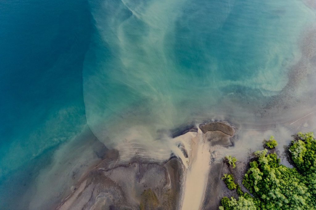
Unlike a human-made artwork, these forms are never intentional. They result from complex and often invisible natural processes. For example, erosion shapes landscapes over thousands of years. Then, sediments carried by water create repetitive and organic patterns. Tides constantly reshape coastlines and draw moving textures. In this way, each landscape becomes a visible trace of scientific phenomena. However, perception plays a key role in this reading. The brain recognizes familiar patterns within natural forms. As a result, abstraction emerges both from human perception and from the landscape itself.
Did you know?
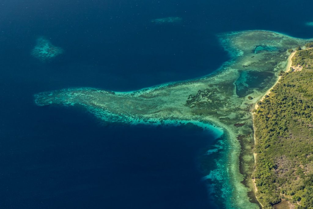
Some river deltas seen from above resemble trees, as their branches follow natural hydraulic patterns.
Natural patterns: lines, textures, and repetition in landscapes
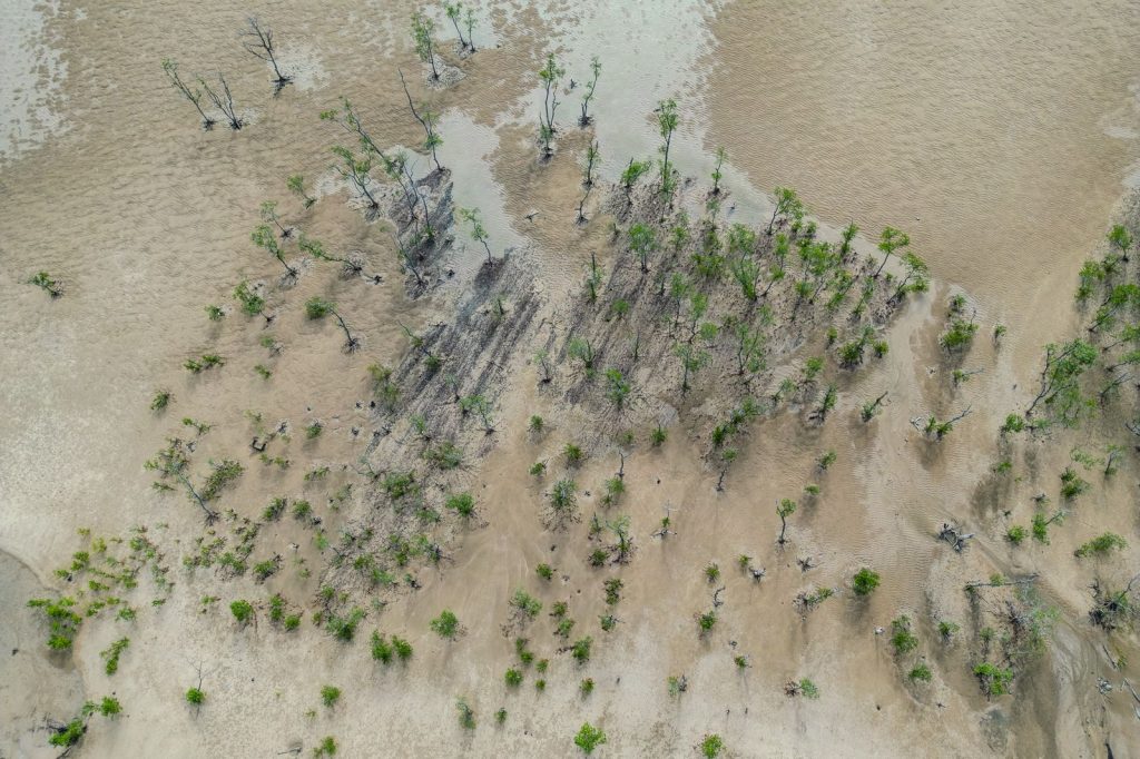
When observing nature from above, certain elements appear repeatedly. Lines often dominate the composition, especially with rivers and roads. Then, textures emerge in forests, deserts, or agricultural areas. In addition, repetition strengthens the graphic effect of these landscapes. Sand dunes, for example, create regular wave-like formations. Similarly, cultivated fields form structured geometric patterns. Thus, nature spontaneously produces compositions close to abstract art. It organizes space without artistic intention, yet with a striking visual coherence.
The role of light in shaping aerial landscapes
Light strongly influences how forms are perceived from above. At sunrise, shadows stretch across the land and emphasize structures. In contrast, direct light reduces contrast and simplifies volumes. As a result, the same location can appear completely different depending on the time of day. Textures become more visible when the light is low and angled. Each detail gains depth and clarity. In addition, weather conditions also affect the visual outcome. A light haze softens contours and reinforces abstraction. On the other hand, clear skies enhance contrast and color.
Did you know?
Sand dunes can move several meters per year, creating constantly evolving patterns.
Aerial photography: between documentation and artistic interpretation
Aerial photography lies at the intersection of observation and interpretation. On one hand, it documents real and measurable territories. On the other, it offers a subjective vision of the landscape. Thus, framing choices strongly influence how an image is perceived. The photographer selects a specific portion of reality and reshapes its reading. Altitude, angle, and light become essential tools. As a result, the final image goes beyond simple documentation. It reveals a hidden dimension of the landscape and proposes a new visual interpretation.
A new way to see and understand the Earth
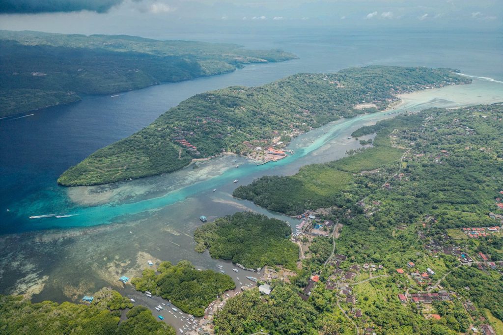
Observing landscapes from above changes our relationship with the environment. This perspective helps us better understand interactions between natural elements. Rivers, landforms, and soils appear as part of a connected system. In addition, this view highlights traces of human activity. Agriculture, roads, and construction reshape natural structures. Thus, abstraction also reveals the impact of our actions. Ultimately, seeing the Earth differently allows us to understand it more deeply. This approach invites us not only to observe, but also to reflect on our place within these landscapes.
FAQ
Because distance reduces visible details. The brain focuses on shapes, lines, and overall structures.
Deserts, deltas, forests, and agricultural areas offer clear and repetitive patterns.
Yes, it affects shadows and contrast. It directly shapes how textures and reliefs are perceived.
No, it is also used in scientific research to study soils, ecosystems, and climate change.
Yes, from aircraft or elevated viewpoints. However, drones provide more control and precision.
Follow us on Instagram and Facebook to stay informed
This article may be of interest to you: Why do some rivers change direction over time?